A+
6
Positive
Eni's run of deepwater discoveries and FIDs on the North and South Hubs have made the Kutei one of Southeast Asia's most active gas provinces. Revised Gross Split terms are attracting investment, although SKK Migas's status remains a watch point. Outlook: Positive.
October 5, 2026
Asia - South East
Onshore & Offshore
Gas
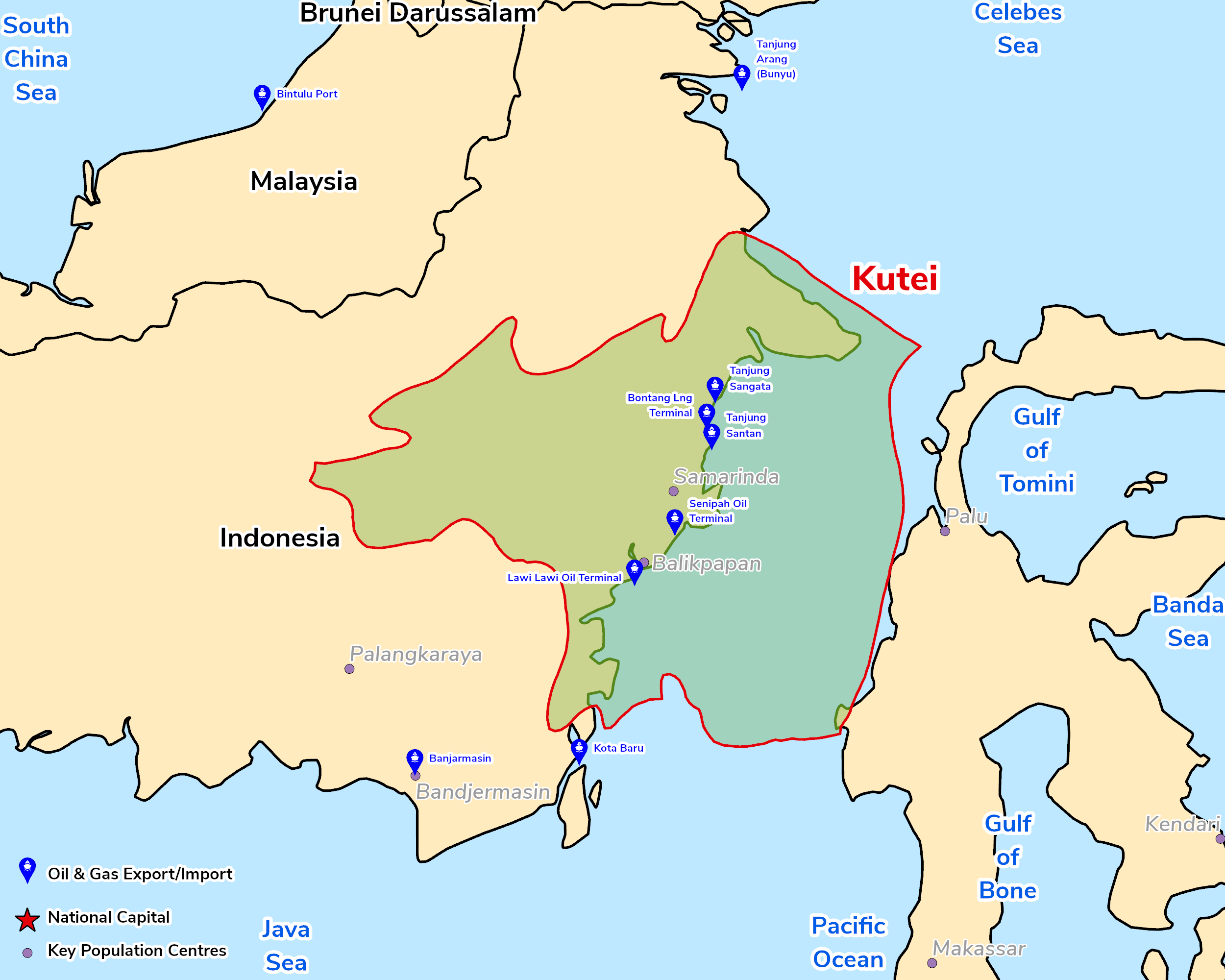
The Kutei Basin of East Kalimantan is the largest Tertiary basin in Indonesia (c.165,000sq km) and one of its richest hydrocarbon provinces. It forms part of a regressive clastic wedge sourced from uplifted areas in western Borneo; since the Miocene the Mahakam Delta has prograded eastwards, depositing up to c.12km of Upper Eocene to Quaternary sediment, with most oil and gas in Middle to Upper Miocene deltaic sandstones trapped in compressional anticlines, folds and thrusts. The first commercial discovery was made in 1897, and by 2019 c.55 oil and 76 non-associated gas fields had been discovered, containing c.3.7bn bbl of oil and 54.2tcf of gas, including deep-water fields. Coals of the Miocene Balikpapan Formation also offer coalbed gas potential.
The Basin has re-emerged as one of Southeast Asia's most active gas provinces. Eni's Geng North (2023), Konta-1 (2025) and Geliga-1 (2026, c. 5tcf in place) discoveries have been followed by FIDs for the North Hub (Geng North–Gehem) and South Hub (Gendalo–Gandang), feeding the Bontang LNG plant. Eni and Petronas' new Searah joint venture plans further exploration and a possible third hub.
Source: ESRI, BGS, USGS & OGA data

© 2024 Oil & Gas Advisors Limited
Website by Rugby Web Design