
D-
111
Negative
The basin lies wholly in Russian waters. The US designation of Rosneft, the main licence holder, in October 2025 closes it to Western partners and services, while unproven petroleum systems, a 9% USGS chance of a commercial field and heavy ice cover leave little prospect of near-term activity. Outlook: Negative.
October 8, 2026
Europe - North West
Offshore
-
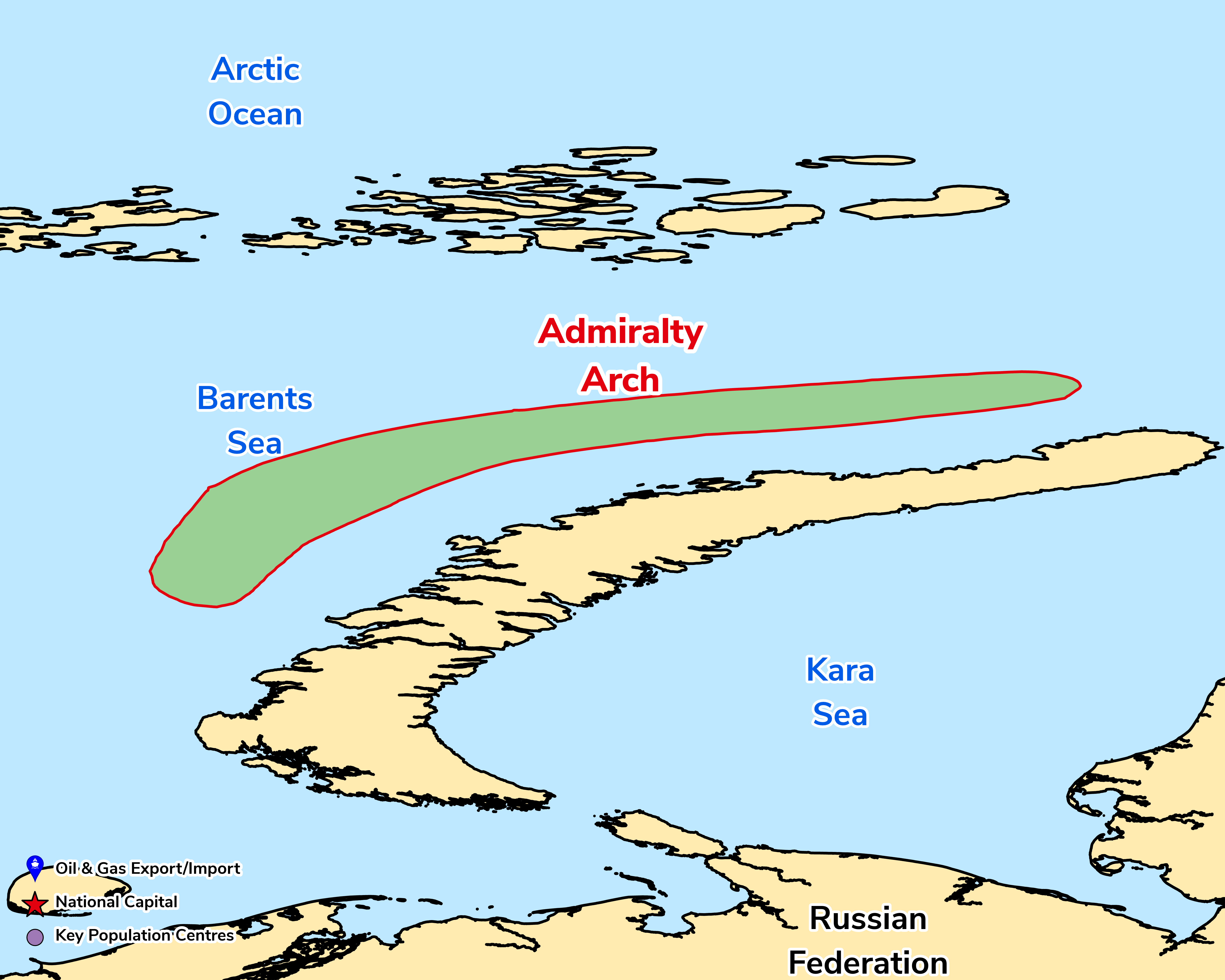
The Novaya Zemlya Basins and Admiralty Arch Province ("AAP") lies on the eastern Barents Sea Shelf in the Russian Arctic, immediately west of the Novaya Zemlya archipelago. Covering c.113,000 km², it comprises structural highs and depressions on the Admiralty Arch, the Novaya Zemlya Monocline and the Sedov Trough, forming a complex of compressional features in front of the Novaya Zemlya fold belt to the east. The South and North Barents Basins bound it to the west. The AAP sits on a former unstable Palaeozoic shelf edge and contains Palaeozoic and Mesozoic shelf, slope and deep-marine rocks. Source, reservoir and seal are inferred rather than proven. Potential source rocks are Lower–Middle Triassic mudstones, Upper Devonian marine "Domanik Facies" and upper Permian mudstones (low TOC where penetrated on the arch). Reservoirs are likely Middle Devonian clastics and Upper Devonian–lower Permian carbonates and reefs, as in the Timan-Pechora Basin. Traps formed during Jurassic–Early Cretaceous compression, after Palaeozoic-sourced generation had largely ended in the Triassic, so early accumulations may have been destroyed.
No fields have been discovered. As of 2007 only three wells had been drilled, one reported dry, and USGS put the chance of a field of at least 50 mm boe at 9%, too low for a quantitative assessment. Rosneft holds licences west of Novaya Zemlya, including West-Prinovozemelsky (acquired 2013), but remoteness and sea ice that covers the area for more than half the year limit activity.
Source: ESRI, BGS, USGS & OGA data

© 2024 Oil & Gas Advisors Limited
Website by Rugby Web Design