
CCC±
89
Neutral
Chile's stable, pro-investment regime, reinforced by the pro-business government of José Antonio Kast, elected in December 2025, supports a Positive country view, and no sanctioned or conflict-affected neighbour bears on the basin. However, this is a remote, high-latitude frontier with no assessed resources, production or infrastructure, the adjoining inshore waters are protected within the Kawésqar National Reserve, and national investment remains focused on gas supply from the Magallanes Basin. Without evidence of licensing or industry interest on the Pacific margin, the country upside does not carry through to the basin. Outlook: Neutral.
October 8, 2026
Americas - South
Offshore
-
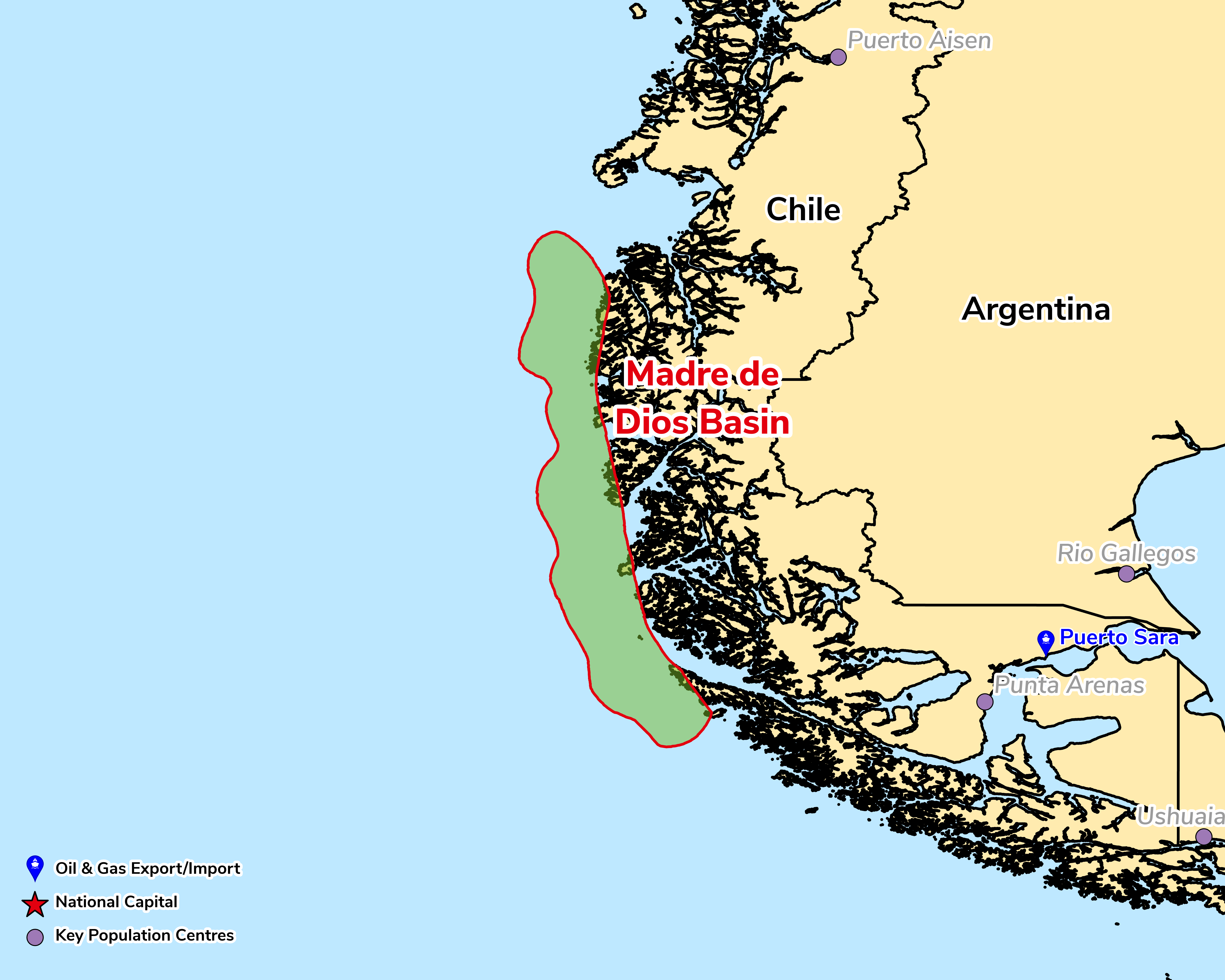
The Madre de Dios Basin (USGS Province 6072) is an offshore forearc basin on the active Pacific margin of southern Chile, in the Magallanes Region, lying seaward of the Madre de Dios Archipelago at about 50°S. It sits between the Penas Basin (Province 6073) to the north and the Diego Ramírez Basin (Province 6071) to the south and, as with other provinces on South America's tectonically active western margin, the USGS places its seaward limit at the 2,000 m isobath. The basement exposed on the adjacent islands is the Madre de Dios Accretionary Complex, a forearc terrane accreted to the Gondwana margin before the Late Jurassic. It comprises the Late Carboniferous–Early Permian Tarlton Limestone, the oceanic Denaro Complex of pillow basalts and cherts, and the thick, continentally derived Duque de York flysch (Middle Triassic–Early Jurassic), and is cut by Early Cretaceous intrusions of the South Patagonian Batholith. The thickness and age of the offshore fill, and its source and reservoir units, are poorly constrained, and the USGS has not published resource volumes for the province.
A remote frontier with no recorded oil or gas production and no USGS-assessed resources. The basin is reachable only by sea, about three days' sailing from Puerto Montt or a day from Puerto Natales, and the adjoining inshore waters form the 2.6 million ha Kawésqar National Reserve, designated in 2019 alongside the Kawésqar National Park, where productive activity must be compatible with the protection of Kawésqar waters. Chile's hydrocarbon activity remains concentrated in the Magallanes Basin to the south-east, where in July 2026 ENAP announced plans to invest US$648 million, including tight-gas fracking at Primavera, gas development at Dorado-Riquelme and Manzano, and its first horizontal wells.
Source: ESRI, BGS, USGS & OGA data

© 2024 Oil & Gas Advisors Limited
Website by Rugby Web Design