
AA+
4
Positive
Guyana's Stabroek Block produces around 900,000 b/d with Uaru due by end-2026, and TotalEnergies' GranMorgu FID has opened the eastern offshore. Stable, balanced fiscal terms on both sides support further investment. Outlook: Positive.
October 12, 2026
Americas - South
Onshore & Offshore
Oil
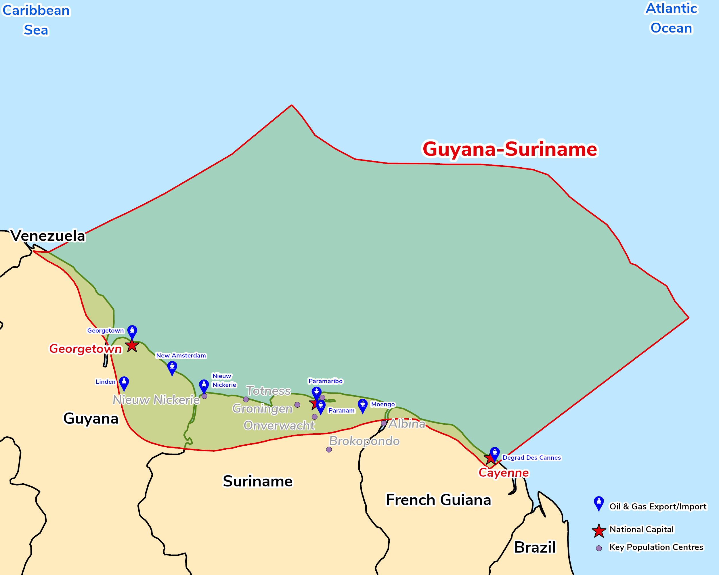
The Guyana-Suriname Basin is an Atlantic passive-margin basin on the northeast coast of South America, formed at a Late Jurassic triple junction related to the separation of the South American, African and North American plates, and bounded to the southeast by the Demerara Plateau. The world-class source rock is the Cenomanian–Turonian Canje Formation, an organic-rich marine black shale equivalent to the La Luna Formation of Venezuela, with a deeper Albian source also confirmed. Since ExxonMobil's Liza-1 discovery in 2015, Upper Cretaceous deep-water slope-channel and fan turbidite plays have transformed the basin, with c.45 discoveries in the Stabroek Block offshore Guyana by January 2025 and further discoveries in Block 58 offshore Suriname.
The GSB is the world's fastest-growing oil frontier: Guyana's four Stabroek FPSOs produce around 900,000 b/d, with Uaru (250,000 b/d) due to start up by end-2026, followed by Whiptail (2027) and Hammerhead (2029). Across the border, TotalEnergies' GranMorgu development in Block 58 is advancing towards first oil, extending activity into the eastern part of the basin.
Source: ESRI, BGS, USGS & OGA data

© 2024 Oil & Gas Advisors Limited
Website by Rugby Web Design